Clauchlands Cycle Route
Distance: 18km Time: – hours
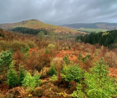
Description: Hard and technical ride through the Clauchland Hills. The route takes in Forestry Roads, tracks and rough trails.
Difficulty: Hard (this is a tough ride for experienced mountain bikers only).
Park & Start
This bike ride starts from the Brodick Ferry Terminal where there a many parking options either within the terminal or along the sea front in Brodick.
Route Map
Route Description
1. From Brodick Ferry Terminal, proceed southbound on the A841 by taking a left turn at the top of the hill.
2. Make a quick turn to the left into a singletrack ascent to Corriegills, the asphalt will ultimately give way to a rocky track on a sharp left-hand curve. Turn right at track marked for Dun Fionn, just before the final house on the road.
3. Keep going up this extremely challenging and steep ascent until you reach a route intersection just as the terrain starts to level out. From here, you will get views that extend over Lamlash Bay to Holy Isle.
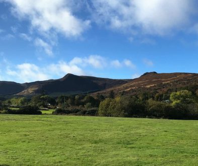
4. Take the marked turn to the right towards Clauchlands Hill, and then continue rising the singletrack. The natural singletrack then rolls up and down, sometimes very steeply, across Clauchlands Hill, which affords spectacular panoramas to both the north and the south.
5. The highest point of the ridge is denoted by a stone Cairn and from this point on, the terrain changes to a tricky, downhill singletrack that eventually meets the forest road.
6. Take the woodland road to the left until you reach the end of it at the singletrack immediately before number 4.
7. Travel back down the path to number 4, go through the gate continuing straight on, and you will eventually arrive at the trig point at Dun Fionn.
8. Ride in a southerly direction along the cliff top until you reach Clauchlands point. This is natural singletrack that is fast and difficult, and in spots, it is rather steep. There are significant drops down to the left, so please use caution. Continue over a rocky field and a style as you get closer to the bottom of the hill. Proceed to the left of the World War II Bunker and descend onto a track.
9. Continue down the path that runs along the coast until you reach a gate leading to a paved road. Continue down the coast road and after passing the hospital, turn right. Just after you cross a bridge, the next turn is to your right.
10. Climb this little road until you reach a T-junction with the A841, then turn right and continue rising the road until you are just beyond the Lamlash Golf Clubhouse.
11. Head over to the gravel singletrack that can be found at the end of the paved pathway that is direct across from the golf course. Carry on along this route as it winds above the road to the crest of the hill, where you will find the forest road leading to the Cnoc Na Dial Forest car park and picnic area, which is located next to the major road leading from Brodick to Lamlash.
12. Keep going onto more singletrack until you come out in a tiny parking area that also serves as a viewpoint. Turn left and stay on the singletrack, which will take you down and over a few wooden bridges as it weaves its way.
13. At the second bridge, go up the rocky trail, passing over the highest point of the hill, and round the closed gate before beginning the descent into Brodick. Be careful as you make your way down this steep slope; there is a blind track crossroad towards the bottom that is often used by cars.
14. Keep going along the tarmac until you reach the T-junction. Take a right into Alma Road, then take the first left after the Co-op, which will bring you to another T-junction. To reach the Brodick Ferry Terminal, continue straight onto the A841 and take the last right turn.
.

